
|
The Southern Townships of Lennox and Addington County
|
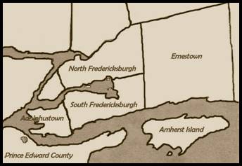
The Original
Township of Fredericksburgh
“Third Town of
Cataraqui”
Boundaries were surveyed by November 1783 but the lot lines were not run until the following year
Settled in 1784 by the KRR NY, Butler’s Rangers and Jessup’s Rangers under Major James Rogers.
Named
for Prince August Frederick, Duke of Sussex, ninth child of George III.
Total
Area: 44,000 acres.
Fredericksburgh
Additional
In
order that all the veterans from The Rogers Corps. were accommodated in a
single township,
land
was taken from Adolphustown and added to Fredericksburgh.
The
numbering of the original Fredericksburgh lots started at Lot 1 and continued
eastward for 26 lots.
The
numbering of the Township of Adolphustown lots also started with Lot 1 and
extended westward for 33 lots.
When
land was taken from Adolphustown the lot numbering remained,
but
lots 1 to 12 were assigned to Fredericksburgh.
This
portion of the former Adolphustown Township was later called 'Fredericksburgh
Additional'.
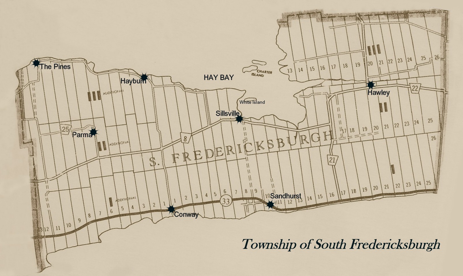
North/South
Division of Fredericksburgh
When
Municipal Governments were formed, many townships had no halls or places of
their own in which to hold council
or
public meetings and taverns were used for this purpose.
Meetings
alternated between the North and South parts of Fredericksburgh Township.
In
the northern part of the township meetings were held at the Lucas Tavern, known
as the
Dew
Drop Inn north of Big Creek Bridge on Country Road #8.
In
the southern part of the Township, meetings were held at Charters' Tavern in
the community of Sillsville.
Both
buildings still stand as residential homes.
Most
people in the southern part of the Township traveled east to Bath for their
supplies
whereas
those living north of Big Creek shopped in Napanee.
As
a result there was no great urgency by either the south or the north to
properly maintain a connecting road.
This
condition remained until the time of the county road system.
There
was an on-going dispute as to where to hold council meetings and the tension
increased
when
a site for a permanent township building was discussed.
Thus
it seemed reasonable at the time to solve the problem by separating into a
North and South Township.
This
occurred in 1857
|
South Fredericksburgh
Click
map for larger view |
North Fredericksburgh
Click
map for larger view |

The
Township of Adolphustown
“Fourth
Town of Cataraqui”
Click map for larger view
Named
for Adolphus, Duke of Cambridge, tenth son of George
III
First
Loyalists arrived June 16, 1784.
11,500 acres